Mount Apo. Situated at Davao del Sur in Mindanao, it is the grandfather of Philippine mountains with the highest peak in the Philippines.
I barely remember why we suddenly wanted to climb this, but a good guess would be as training for the sudden Kota Kinabalu Climbathon. And why are we going to the KK Climbathon? We are adventure seekers a little bit on the daring side but I really don’t know why we go for extremes.
In any case, I like it!
I received the climb invite on April, and with little hesitation I booked my flights. I didn’t catch any promos so the total roundtrip fare took around 4000 Pesos. Once the group was finalized, the preparation was coordinated – itinerary, documents, tips, gear, meal plan, transportation, guides, porters and and other people to contact. Many requirements were handled by our local friend. If you don’t have a Davaoeño friend, I guess you could coordinate with the outdoor shop EDGE.

I’m no ad expert but I think that’s a one-armed headless man on the sign.
Some of us went ahead a night earlier and stayed at BS Inn. It was so-so – very light on the wallet and able to accommodate large groups together. Aside from the lobby, it felt cold and gloomy like a hospital. On the way to our rooms we got to pass sinks filled with unwashed dishes and our beddings were dusty. There was cable TV though and we got to see the opening of the world cup through the diagonally-challenged device. The name of the place was also a conversational piece good enough for a minute of entertainment. Add 30 seconds if you’re good.
Best point:
Cheap!
Worst point:
Cheap!!

You get what you pay for.
But before we went to bed we had dinner at Penong’s (I think?). The food was ok but even though they are still open it seems they weren’t expecting customers past 11 PM. Lots of dishes (even drinks!) weren’t available anymore, the waitress/server took long to attend to us even when we were virtually their only customers left, and the tables around us were unappetizingly unclean.
The rest of the group arrived 5:40 AM the next morning and went straight to fetch us at BS Inn. Sticking to the meal plan, we had breakfast at Jollibee and take-out food for lunch. We went to the Edge store to get some equipment and then stopped by at a Mercury Drugstore for water and some grocery items. Lastly we stopped at the Shell station near the right turn to Kapatagan. You can use this as the last convenience store and toilet break because it’s all sari-sari stores and latrines from then on.
About an hour into the Kapatagan road, right at the Mountaineering Information Center, is the junction to Camp Sabros. Last October all of us were at Davao and Camp Sabros was one of our stops. It was there that some of us got a first glimpse mount Apo, admiring its bald peak with no desire to conquer it. It was also at that trip I first met Rochelle Sy Chua.
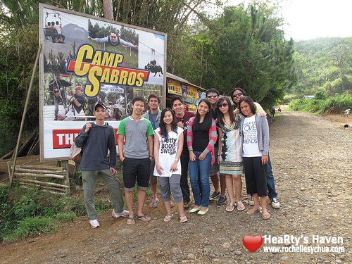
Because nobody gave me a copy, this image stolen from Roch’s Flickr!
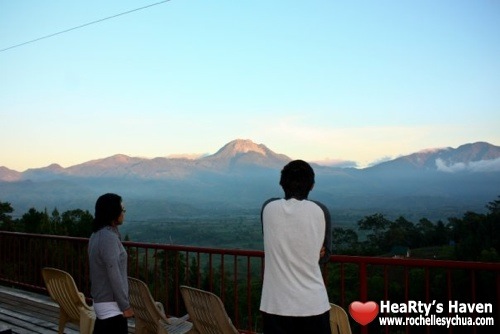
Didn’t cross my mind that we would be climbing THAT.
From this junction it was an hour and a half of steep, winding dirt roads. All in all, it took around 3.5 hours drive from Davao city to the jump-off point. This was not at the end of the road, nor were there any signs. It was just there – an unmarked, low fence by the side of the road. We handed over our extra baggage to the porters, crossed the fence, and began our ascent.
The first 1-2 hours of trail was inhabited grasslands, and there was a lot of garbage on the ground. The trash was a mix of local fare (local junk food like squid rings) and obviously foreign trash (bars, gels, trail food). We were delayed to begin with so we were toasting under the noon sun. Thankfully our jump-off point was already in high altitude and the area was open so there was fresh mountain breeze. We ate our lunch take-outs at the shed by the welcome sign, with a public latrine and some sari-sari stores nearby.
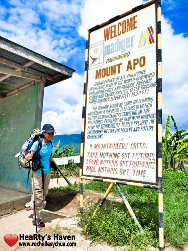
Sorry, I was about to leave something other than footprints.
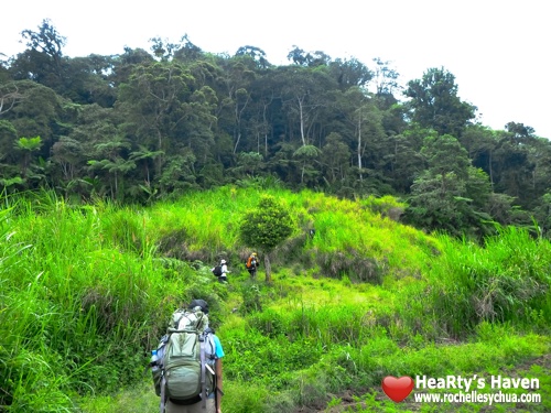
The view was of wide, open fields with banana plants, coconut trees, corn fields, carrot rows, and cabbage patches. There was no electricity in the place and life looked very simple. We couldn’t see past the forest because the mountain was covered by heavy clouds.
The trail here is very easy, just avoid the dung and endure the dense undergrowth deeper into it. It would be good to have your arms covered already. And do take time to greet the locals you encounter – you’re passing through their land!
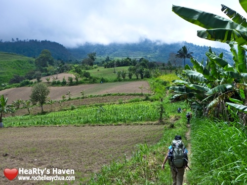
Easy trail across the inhabited farmlands.
The foliage gets very thick very quick.
The transition from grasslands to the forest is abrupt. Suddenly the grass is gone, the sky is obscured, and you’re surrounded by trees. The trail got technical from here while leading endlessly uphill. There were lots of spiky plants, trees and vines, and some areas were filled with sticky mud. There were orange flowers, mushroom formations and radiant forest moss for eye candy. There were also birds singing and crickets chirping. Almost no bugs pestered us, just a single bee that seemed to follow us all throughout the trail up even to the summit camp and then back down.

Welcome to the jungle! Watch it bring you to your knees!
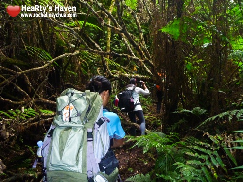
An untamed place…but take it respectfully and see that nature is gentle.
The right trail was well-weathered and also marked by yellow ribbons. Be alert and you should encounter at least one every minute around vines, trees and branches. While in the forest it is a good idea to have both hands free or equipped with trekking pole/s. It took us around 2.5 hours upon entering the forest till Tinikaran Camp 1. Plan your time well, and be quick if you’re running very late. By no means should an unfamiliar trekker be caught in the dark while in the forest trail. Darkness quickly descends starting 5 PM. By 6 PM, it gets very cold and there is total darkness.
We spent the first night at Tinikaran Camp 1, at an altitude already higher than Baguio’s. We had chicken noodle soup, grilled tuna, boiled cabbage and rice for dinner. We washed the dishes and utensils, entered our tents and tried to sleep at 7:30 PM. You could listen to cricket song and watch fireflies shimmer all around the forest. I just lied down but I couldn’t fall asleep. Especially past 9 PM when it rained.

Daybreak at Tinikaran Camp 1.
And boy, did it rain so hard. Our tent was under a tree, but the rain was just so strong. Notice that our tent had no fly. We draped the ground tarp over the top to the back ventilation so the rain wouldn’t get in. Still, the moisture inside the tent condensed so anything touching the tent will get wet. I woke up countless times because my feet were touching the tent. All night there was total darkness even when you open your eyes save for flashes of lightning. There was a marvelous chorus of torrential rain, booming thunder, frogs, birds and crickets. Amidst the discomfort it was an amazing sensory experience. We still woke up feeling fresh the next day.
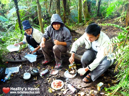
SPAM came from Survivalist Packed Assorted Meat.
Kidding. It’s actually SPiced hAM (and mystery meat).
Daybreak. We planned to get up 5 AM, but it was still so cold and dark outside. We went out of our tents near 6 instead. We had crackers and bread with SPAM cooked with olive oil. Extra virgin olive oil. Which was actually used in our Pinoy Henyo session. What is it with SPAM that makes it so good? Is it the spices? Or is it the mystery meat? Must be the mystery meat.
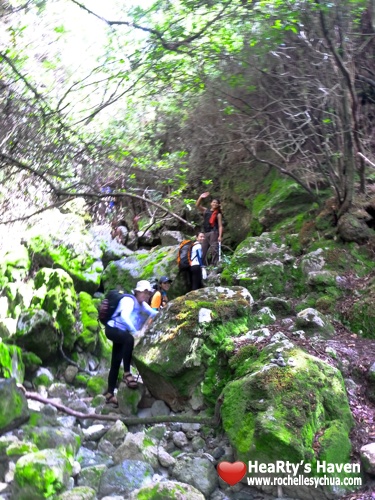
Marking the transition from forest to boulders are…boulders in a forest.
We set out past 8 AM, arriving 9AM at Tinikaran Camp 2 for a quick break. Half an hour later, the forest thinned out as we entered the boulders section of the trail. One of the first sights that will greet you here are the giant sulfur vents. We marveled at it not knowing we’ll be passing so near alongside it. At the worst of times when the wind blows from the direction of the vents, the gases sting the eyes and lungs like diluted tear gas. It is advisable to cover your nose and mouths. No need for goggles. The effects wear off immediately once fresh air blows from the other way.
Aside from the bad gases, the air at this altitude was very thin. I could only manage short bursts of speed climbing before sitting down, out of breath and gasping for air. Rinse and repeat.
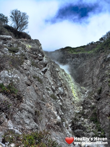
Few things are more encouraging than choking on sulfur vents.
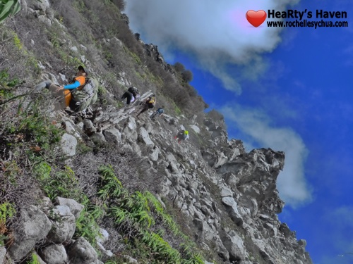
The boulders go up to clouds…
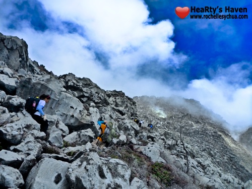
…and up into clouds…

…and up beyond clouds.
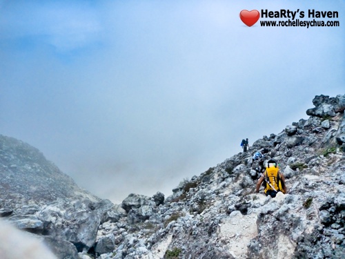
Some parts are a graded slope around the mountain.
The boulders route is marked by sticks with white ribbons and arranged formations of two vertically stacked rocks. You should be able to plot your path to the next marker when you’re standing near one. Please don’t mess these up by taking sticks as souvenirs or removing the rocks. They are conveniently placed just alongside the way to guide trekkers. Don’t try public service by stacking another rock to make the markers more prominent. Three stacked rocks mean “danger.†The trail being naturally dangerous as it is, a “danger†marker should be taken seriously.
How about four you say? Well I don’t know. Just don’t touch the trail markers and leave the arrangements to the experts.
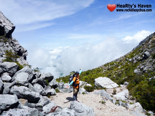
A final rest stop before the ascent to the crater.
After 2 1/2 hours with 2 rest breaks, we arrived at the final rest stop before the crater. The view here is clear, and at moments when nearby clouds roll out you can see a sea of clouds. The summits were very visible from that point. With the goal so near exhaustion takes a backseat.
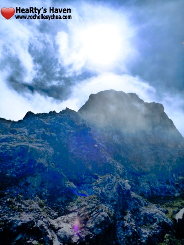
You can see the summits clearly from then on.
The crater was just 30 minutes of steep climb away, on a path strewn with fertile wildberry shrubs. I think I picked more than a hundred of them during that ascent alone. It’s nice morale food and also seems to be a good source of natural sugars and carbohydrates. I didn’t have any tummy complications even after consuming a lot. And I did consume a LOT of it, lingering on the trail and scouring back forth to shamelessly hoard ripe berries. I got so busy foraging I didn’t realize that the crater was only a few seconds away! Eventually the others at the top noticed I was missing and called me up to join them.
I obliged, then all weariness was blown away.
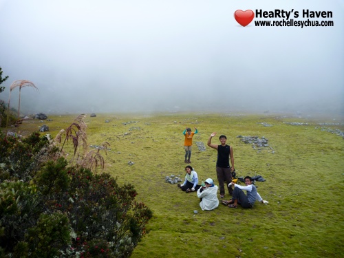
Amazingly wide, flat, clean, soft grassy plain on the dead crater.
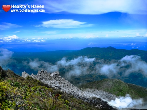
The crater opening overlooks Davao. That’s Samal island at the upper left.
The experience was superlatively wowmazing and photos do not do justice on the scale and magnitude of it. The crater was so wide and perfectly flat, with a floor carpeted by the softest grass. It had Apo’s three summits for walls and a scroll of rolling clouds as its roof. Look out from the crater opening where you passed through, and you could see miles away Davao, Samal island, and beyond to the open ocean. Just. Amazing.
We had lots of fun on the crater. Like energetic little kids let out in the open field, we ran and crawled and jumped and strolled and arranged rocks and rolled around.
After exhausting ourselves all over again, we went up to one of the summits then back down to the summit camp.
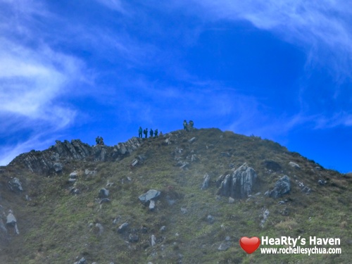
Other hikers at the opposite summit.
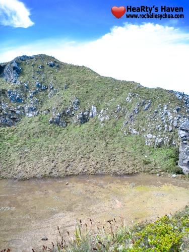
Zoomed out for scale. Those are people on the ridge.
This summit camp is a wide stretch of flat land, with tall grass clumps around 2 meters and higher serving as natural dividers between tents and improvised toilet areas. Generations of trekkers have flattened the grass in parcels just right for small groups of people to dwell in. There were even secret pockets completely encircled by the tall grass save for an entrance. And of course our guides, who arrived at the area first, called first dibs to it.
This camp had a water source – a bamboo tube protruding from the side of a dug-out section of the mountain. Where the water comes from I don’t know. I didn’t see any glaciers on top of Apo so I guess it was a natural spring pushed up from below. I hope it comes from below because there was lots of poopie on the camp already.
I should know, because I added to it. Nothing made me feel more like a bona fide mountaineer than that. 😀
Oh and check out the amazing view from the water source. We were excited about a lake visible just below the photo frame, but somebody said it wasn’t the famous lake Venado. We wanted to go down the trail going through Venado, but our guide advised that the area is currently an active training ground for the “Bagong Hukbong-Bayan†and for safety reasons we should just backtrail. The risk was minimal and these people are apparently good people, but hey, trust your guide – he knows the place and the people and that’s probably why you hired him. Inarguably, we have no business hoppity-hopping over territory they claimed. Maybe next time~
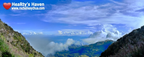
Amazing view from the summit water source
The camp was foggy from 4 PM. The fog was actually clouds rolling over the high ground so I think it’s a whole-day phenomenon for this camp. Nightfall was sharp again, bringing complete darkness and biting cold as early as 6 PM. We quickly prepared dinner and washed the dishes so we can retreat to the protection of our tents. Visibility was just a few meters even with powerful lamps. Unless a bonfire is allowed, there isn’t much you can do outside your tents. Bonfires are not allowed.
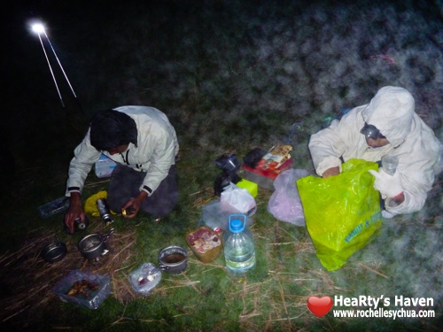
Extremely dark and foggy night. This was just past 6 PM.
However cold it was, we were prepared with our thermal gear this time. Full, tired, entertained with Pinoy Henyo and having finally accomplished reaching the mountain’s peak, this was a smoother night to sleep for us. Still, some of us couldn’t sleep and woke others up by talking nonsense around 9:15 PM. Once that was settled, we got back to sleep quickly.
Then the unexpected happened – it rained! We didn’t expect it to rain so hard when we were so high above heavy clouds. Paired with very strong, chilly wind, sleep was near impossible. There was ginormous condensation inside the tent and the wind was knocking it off onto our faces and was just making a big racket. I was weatherproof waist up but my gloves and socks were cotton and I didn’t have thermal wear for my legs. Thankfully the sleeping bags we spread out at as our mattresses were water resistant so the water from below the tent couldn’t reach up and drowned us in our sleep.
Yep, we spread out the sleeping bags to our backs instead of using it to cover our bodies fully. Why? Because we had 2 sleeping bags for 4 people. Why? Ask somebody else!! We barely slept that night, and we even have a video of our ordeal on 1:15 AM.
It was crazy. But soon enough the rain stopped, the sun rose up and we were greeted by a very cold, very wet, very foggy morning.
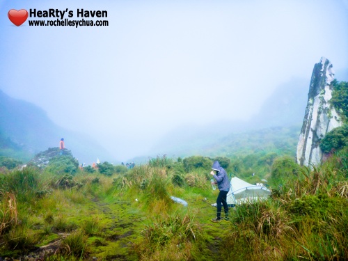
Not really a good morning. This was taken after the worst has passed.
Though the sun was up early, the cold was unforgiving and the temperature outside didn’t get tolerable till around 7 AM. We took our burners inside the tent and heated water there to ease the cold. The air outside was so dense with moisture it was like being in a nebulizer.
Breakfast was chicken macaroni soup, heated canned tuna, canned sausage and cheese spread on crackers and bread – all prepared inside our pleasantly warm tent. We also had hot Milo and naturally refrigerated iced tea. Looking back at the cold, hard night it actually turns to a good experience. That is, once you’ve ensured you and your comrades are alive and kicking.
We packed our stuff, did our final peak photo ops, and began our descent starting 9 AM. The fog was still thick and visibility limited to a few meters but the sunlight was good enough to reveal the trail since 7 AM.

High altitude. Low visibility. No problem.

The atmosphere doesn’t clear till you descend below the clouds.
We split into 2 groups in the boulders. We regrouped and had our late lunch of delicious pork adobo in Camp 1. Afterwards we split into 3 groups that arrived 4:30 PM, 5:00 PM and 5:31 PM at the village at the foot of the mountain.
The descent from the summit was a knee-busting slipfest for me, as I tallied:
- 9 slips that got me landing on my butt, including one that got me flat on my backpack and wrapping my unprotected arms around a rough tree;
- 1 bad “tapilok†that thankfully didn’t cause an ankle sprain (I’m prone to ankle sprains especially my right foot); and
- At least 4 slips that got me off balance, including 1 that broke the point of my trekking pole, and one that made me grab a spiny tree trunk.
Yep I counted. It was good entertainment to keep score against the nasty trail. My 4:30 PM trekmate, on the other hand, led the pack and slipped only once. Kudos!
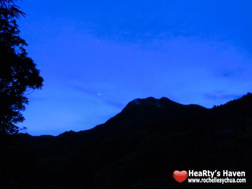
Including breaks, our descent from there took 8-9 hours.
We arrived at Davao City 9 PM already. Tired, dirty and battered, we were looking for a good place to stay this time around. Our local friend suggested Legaspi Suites and it didn’t disappoint. We arrived almost 10 PM but the hotel staff was quick to respond to our needs. Their restaurant even took orders for us well past 10. My taste buds weren’t dulled by the mountain air and I’m sure the food preparation was still topnotch. They also offer room service massage, but we were really running late so we passed on that one. Good thing because an expert mountaineer advised against it, prescribing a recovery run instead.
Key points in our stay:
- Premier room for 1900 + 600 for extra bed
- Nice hotel with an open and breezy atmosphere.
- Good location near banks and a convenience store
- Courteous, responsive and very accommodating staff
- Comprehensive amenities and establishments – restaurant, massage parlor, bar, coffee shop
- Room and extra bed rates inclusive of set Filipino breakfast
- Spotlessly clean rooms with quality mattress and pillows
- Room phone, cable TV, Wi-Fi, hot & cold shower, quality soap and shampoo
- Open-air passageway/balcony we could leave our wet shoes on
- Taxi ferrying services
- No bidet nor ‘tabo’ in the Premier toilet
- Filipino breakfast was not excellent

Premier room. 3 staff expertly set up my extra bed in record time.
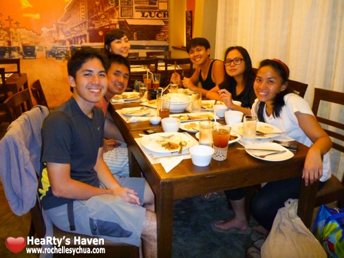
Dinner at their cozy Kusina Selera. They accommodated us even past 10 PM.
It was only when I was lying down on a modern bed in clean clothes, having had a soothing warm shower and a filling hot meal, that I recounted what we went through the past three days. There is a lot we take for granted among the daily comforts we enjoy in civilization, but we can survive without it. And there is also a lot we are missing by not daring to venture out from our concrete jungles and domesticated vacation spots.
We didn’t conquer mount Apo any more than we conquered ourselves. As fatigue gave way to sweet sleep, I knew the Apo experience was stuff dreams are made of. A story to tell our children. Truly unforgettable.
God-willing, this will be just one of many.
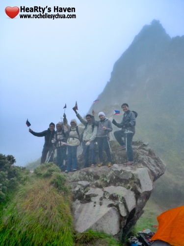
We didn’t conquer mount Apo any more than we conquered ourselves.
Cliché cliché!
*RING*RING*…Wake-up call. Sleep passed like a blink of the eye. The breakfast was room service as the restaurant was still closed. We weren’t impressed with the food this time – it was just warm rather than hot, the “hot chocolate†meant a Milo sachet, and they ran out of condiments. The meal was still filling though, and there was little time to be picky. We tried to postpone the taxi trip to steal a few minutes for shuteye, but the taxi was already dispatched to get us.
We got at the airport early but there was no time to loiter because as always, the boarding gates inspection line gets long very quick. I picked up 2 kilos mangosteen fruit, durian yema that is very durian-y, some mangosteen candies, and tuna chicharon. It tastes like meaty pork chicharon, just a hint fishy. I don’t know if it’s “healthier†though. If you’re a health buff you should be found nowhere near deep-fried animal skin.
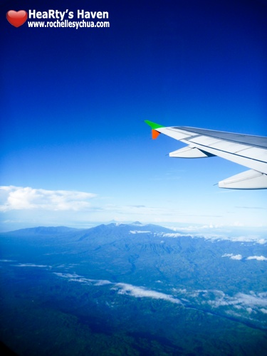
Alas, goodbye, Mt. Apo. It has been one good adventure.
Want to climb mount Apo? It’s easier than you think and harder than you think. Include it in your prayers and petitions – persevere in prayer all throughout. Get acquainted with reading trails through tutorials and trail runs – there are numerous trail runs organized lately. Build a moderate cardio base, strengthening your core and legs. Be with good people sharing the same passion. Ask for specific tips and guidance from those who have come before you. Finally, get the right equipment, put your heart into the goal, get a good guide, and have loads of fun!
What’s in for you in the Kapatagan trail:
- Make your way through a dense tropical forest trail with little worries about leeches, mosquitoes and poison ivy.
- Climb, crawl, walk and jump over hundreds of perilous boulders while choking and gagging on gases from the sulfur vents.
- Replenish yourself with cool, naturally-filtered mountain water.
- Look down over clouds. Touch, breathe, and taste clouds. Like being in a giant nebulizer.
- Forage for wild berries fresh from the trail.
- Do all your washing with freezing cold water.
- Do No.2 in the wilderness!
- Try to get enough sleep in a freezing cold, rain-drenched tent.
- Stop a slide on the rocks by spreading your arms and then get burnt by covert, little sulfur vents.
- Stop a fall in the forest by clinging onto a tree which doesn’t look as thorny as it is.
- Have the freedom to risk life and limb on a fast, knee-busting descent.
When the day comes and you are not ready, don’t be afraid to cancel the Apo climb but not the flight – there’s lots you can do in Davao!
——————–
Mount Apo
Davao del Sur, Philippines – 6°59′15″N 125°16′15″E

ooohhh wow, great memories in apo 🙂 will definitely do it again one day 🙂
Like! 🙂 You captured the experience quite well and put them to such easy-to-read words 🙂 Kudos Nell 🙂
yay talaga? salamat 🙂
*LIKE*
very helpful blog! thanks..
very helpful blog! thanks..
Excellent! You’re using the Sibulan Trail of Sta. Cruz not the Kapatagan Trail. The Kapatagan Trail was on the other side proportion to Sibulan Trail where you can experience the astonishing sulfur deposits. Kudos!
excellent mga sir and mam..i salute you all!